FAQ
No special software is needed. You only need a stable internet connection and a computer or tablet capable of joining a standard video call (Zoom or Google Meet) to view our screen share.
Yes. It is one of our most popular services for prospective buyers looking to uncover hidden flood hazards, landslip risks, soil issues, or access road challenges before making an offer on a listing.
You submit your property address, lot plan, or real estate listing link beforehand. During the video call, we share screens to review live GIS contour maps, elevation profiles, and catchment runoff models together.
Yes. For properties exceeding 20 acres, we focus intensive ground-truthing on your priority “Focus Zone” or major catchment infrastructure while analyzing broadacre contours via GIS data.
Complete our discovery form and provide any existing site boundaries or contour maps. We pull and analyze satellite elevation and catchment data prior to arriving on site.
It is ideal for broadacre property owners, homesteaders, or commercial agricultural projects requiring deep, hands-on engineering consultation, physical site marking, and comprehensive zone planning in a single intensive day.
Complete our discovery form and provide any existing boundary maps, contour data, or specific earthworks goals so satellite data can be reviewed prior to arriving on site.
Yes. It is an ideal way for buyers to identify hidden flood hazards, landslip risks, poor drainage, or unviable building pads before finalizing a contract on a property.
The 2-hour walk is a rapid visual assessment. The 3-Hour Engineering Audit is an intensive technical evaluation designed for complex sites, severe erosion issues, steep topography, or major dam and earthworks engineering.
Yes. We offer remote GIS masterplanning using satellite elevation data globally, or on-site consultation options for properties in South East Queensland.
Yes. Upon placing your order, complete the Premium Remote Design Discovery form so we have your site coordinates and property goals to begin modeling.
You receive a high-resolution GIS property blueprint, hydrological overlay (swales, dams, drainage), zone infrastructure plan, and a phased implementation roadmap.
This package is specifically tailored for rural residential blocks, homesteads, and small farms between 1 and 20 acres.
We review all project submissions and emails within 1–2 business days. If you submit a discovery form, we will analyze your site coordinates and follow up with the next steps or booking options.
On-site feasibility walks and consultations are regularly conducted throughout South East Queensland (within 100km of Brisbane/Sunshine Coast without extra travel fees). For excavator wet hire, machinery is sourced locally at your project destination, allowing services to be delivered anywhere in Australia or globally.
Yes. If you have a property over 100 acres, require specialized earthworks, or need commercial consultation, submit your details through our Custom Quote Request Page or send us an email directly.
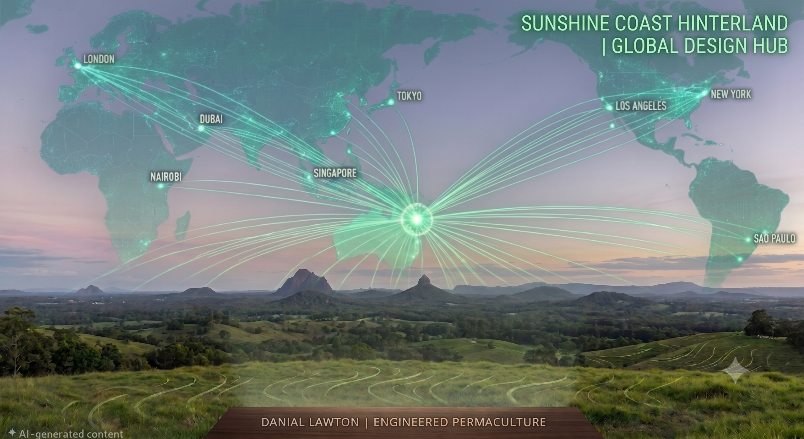
Based in Conondale on the Sunshine Coast, QLD, we provide on-site consultations across South East Queensland (Sunshine Coast, Gympie, Brisbane, Gold Coast) and deliver remote design strategies and earthworks operation worldwide.
As a qualified permaculture consultant and environmental engineer, Danial Lawton provides GIS-based permaculture masterplanning (urban, acreage, and broadacre), civil-grade 1-in-100yr hydrological engineering, remote strategy consultations, on-site feasibility walks, and precision excavator wet hire.
Services are available worldwide. Because machinery is rented locally at the project destination for me to operate, wet hire services can be delivered anywhere in the world (including Brisbane, the Sunshine Coast, greater Queensland, interstate, and international locations). Equipment sourcing, float transport, and travel fees are calculated based on your property location.
Contact us directly with your property location, desired timeline, and project scope so we can factor in local equipment rental, mobilization logistics, and site operator time for a custom quote.
Machinery ranges from 6-ton up to 24-ton excavators (sourced locally to fit your site requirements) to handle projects from small urban retrofits up to broadacre dam construction. Other sized machines are available through other products or by request.
“Wet Hire” means you get the heavy equipment together with an expert operator—in this case, a Master of Environmental Engineering in the seat. Instead of relying on local machinery transport limitations, equipment is rented locally near your site, and I personally operate it to execute your masterplan.
Properties within a 100km radius of Brisbane do not incur extra travel fees. For properties outside this radius, a standard travel fee is automatically quoted in your cart upon entering your address.
This 2-hour session is a visual on-site evaluation. The 3-Hour Intensive Engineering Audit is required for projects needing formal 1-in-100-year storm modeling, complex hydrological calculations, and technical engineering specs. For larger properties or more complex problems.
You can review proposed placements for dams, swales, access roads, and infrastructure, as well as get immediate troubleshooting advice for active erosion, poor site drainage, or failing earthworks.
It is a rapid, visual walk-and-talk feasibility check conducted directly on your property by an Environmental Engineer and experienced earthworks operator to evaluate proposed site changes before earthworks begin.
Generally within a week.
No. You can complete the discovery details and complete the checkout process for $0 to submit your request for review.
You can request a quote for rural & acreage design, earthworks & water systems, pre-purchase property assessments, project implementation/management, or speaking engagements and workshops.
It is designed for anyone who wants a custom quote for any service offered—whether for bespoke designs, specialized consultations, broadacre properties (100+ acres), commercial farms, eco-resorts, or complex earthworks.
Rather than relying on generic tips, this consultation combines ecological principles with environmental engineering physics to evaluate water flow, soil mechanics, and site limitations with scientific rigor.
Yes. You must complete the Premium Remote Design Discovery form upon ordering so your site data can be reviewed prior to your session.
It is ideal for prospective buyers needing pre-purchase land evaluations, DIY homesteaders stuck on complex hydrological or layout issues, or landowners wanting expert advice before committing to major earthworks.
It is a 1-on-1 remote consultation with a Master Environmental Engineer and 2nd-generation permaculturalist designed to give you strategic guidance, property assessments, or targeted problem-solving without needing a full masterplan.
Yes. When placing your order, you must complete the Premium Remote Design Discovery form so our team has all the necessary site details to begin your custom design.
You will receive a high-resolution Core Blueprint (visual site layout), a Water & Infrastructure Overlay, and a step-by-step Implementation Roadmap.
The package includes micro-climate & sun mapping, intensive backyard food forest design, urban passive water harvesting plans, and aesthetic integration layouts.
This design package is tailored specifically for urban and suburban residential blocks under 1 acre.
It removes all guesswork. Instead of an excavator operator guessing spillway dimensions or pipe sizes, you receive a Spillway Engineering Brief with exact mathematical cross-sections and level-sill specifications.
It includes peak flow catchment calculations, precision dam spillway dimensions, inflow/diversion strategies, energy dissipation plans, freeboard/stability specs, and culvert/pipe sizing.
A 1-in-100-year storm event refers to a severe rainfall event that has a 1% probability of occurring in any given year.
No, this is an add-on product. It is designed to complement a primary Acreage or Broadacre Masterplan and cannot be purchased independently.
Unlike generic lists, this is a bespoke technical manual tailored specifically to your site’s unique microclimates, soil chemistry, and your maintenance capacity to ensure a self-regulating ecosystem.
You will receive a comprehensive digital plant list formatted for easy reading that functions as a master shopping list you can hand directly to a nursery.
It includes climate-specific selections, functional permaculture guilds (nitrogen fixers, dynamic accumulators), multi-strata food forest plant layers, and native/endemic integration.
No, this is an add-on product. A primary masterplan design must be purchased alongside it and it cannot be purchased independently.
You will receive a high-resolution digital planting overlay matching your main property masterplan, showing exact species placement to maximize survival and yield.
It includes precision food forest and orchard layouts, earthworks integration (planting on swales and dam walls), windbreaks and shelterbelts, and permaculture tree guild zoning.
It is a high-precision digital overlay on a coordinate-locked grid that allows you or your contractors to walk the land with a mobile device and locate every planting site with GPS accuracy.
No, this is an add-on product. A primary design masterplan (Urban, Acreage, or Broadacre) must be purchased as well.
The process consists of 4 steps: 1) Fill out the intake discovery form, 2) Complete your product checkout, 3) We pull the topographical and hydrological data to build your mapping strategy, and 4) We hand over your final Strategy Map and consult with you on implementation steps.
Yes. When placing your order, you must also complete the Premium Remote Design Discovery form with as much detail as possible about your property and goals.
If your property exceeds 100 acres, you have two flexible options:
-
The “Focus Zone”: Apply the package to a targeted 100-acre block to phase your farm’s development.
-
Whole Farm Master Plan: Request a custom quote tailored to your exact acreage and topographical complexity.
The package includes three core components:
-
Full Topographical Modeling & Strategy Map: Accurate large-scale models to identify microclimates and plan infrastructure like access roads, fencing, and machinery corridors.
-
Large-Scale Hydrological Catchment Mapping: Macro-hydrology analysis of natural catchments and watersheds for safe, engineered passive water harvesting systems (swales, keyline plowing, high-capacity dams).
-
Commercial-Scale Regenerative Consultation: Alignment of mapping data with your commercial goals to map out holistic grazing systems and agricultural layouts.
No. This is strictly a “Wet Hire” service. You are hiring the machinery accompanied by a Master Environmental Engineer to safely and accurately execute your earthworks to exact hydrological grades.
Yes. A 3T to 5.5T excavator is the ideal size for building small-sized farm dams, cutting keyway core trenches, and shaping level-sill spillways.
Daily rates for this tier reflect the specialized, high-spec attachments used (such as tilt buckets and laser levelling receivers) and the high-precision nature of acreage work. You are paying for engineered accuracy and soil protection rather than crude, bulk-dirt moving power.
It depends on the task. The Mini Excavator is designed for digging (trenches, deep swales, stump removal). The Mini Posi-Track is designed for pushing, spreading, and leveling bulk materials (moving huge piles of mulch or scraping topsoil). For many backyard makeovers, hiring both machines together is the most efficient strategy.
No. This is strictly a “Wet Hire” service. You are hiring a highly specialized machine accompanied by a Master of Environmental Engineering to safely operate it.
In most cases, yes. Our mini Posi-Tracks require a minimum clear width of roughly 1.2 to 1.3 meters depending on the specific machine deployed. We highly recommend measuring the narrowest point of your access (including air conditioning units or hot water systems on the wall) before we arrive.
Yes. For large projects like dams and major swale systems, pairing the excavator (for deep digging) with the Posi-Track (for moving the bulk dirt and final grading) is the most efficient, cost-effective way to execute earthworks. Please contact us directly if you need a dual-machine project quote.
No. This is strictly a “Wet Hire” service. You are hiring a 5-ton machine accompanied by an Environmental Engineer to safely and precisely operate it on your property.
A traditional “Bobcat” usually refers to a wheeled skid-steer. Wheeled machines exert high pressure on the ground, causing deep ruts and severe soil compaction, and they easily get stuck in mud. A Posi-Track (compact track loader) runs on wide rubber tracks, giving it immense traction, stability on slopes, and a very “light footprint” that protects your soil profile.
This specific booking is for the machine and operator hire only. However, if you need a full-service solution where we source, spread, and compact the materials, please contact us for a custom project quote.
Our tandem rollers are designed for tight urban environments. We generally require a minimum clear width of 1.2 to 1.5 meters depending on the specific machine deployed (1.5T or 2.5T). If you have a standard side access gate, we can usually fit. We will verify your access dimensions before arriving on-site.
No. This is strictly a “Wet Hire” service. You are hiring the machinery accompanied by a Master of Environmental Engineering to operate it. This ensures the correct vibration frequencies and passes are applied to your specific soil type to achieve maximum compaction density.
Yes, if the deposit option is available at checkout, you can secure your seat with a partial payment. However, please note that all deposits are strictly non-refundable, and your remaining balance must be paid in full prior to the start date of the course.
Yes. While we provide full catering (standard meals, snacks, and tea/coffee) for all students, we do not have the kitchen capacity to safely manage strict allergies, vegan, or highly specific dietary requirements. If you have strict dietary needs, you are welcome to bring your own pre-prepared meals.
No. While this course covers advanced engineering concepts, the curriculum is designed to take complex mathematics and break them down into practical, easy-to-understand field applications. Whether you are an experienced contractor or a beginner landholder, you will be able to follow the step-by-step frameworks.
Earthworks are highly weather-dependent. Light rain provides excellent opportunities to observe surface hydrology in real-time. In the event of severe, unsafe weather that prevents machine operation, we will pivot to advanced site-surveying, laser levelling, and indoor strategy sessions, maximizing your educational value regardless of the weather.
If you have existing earthmoving experience or a strong foundational knowledge of permaculture hydrology (swales, keyways, and spillway calculations), you are welcome to attend. However, we will not be pausing the machines to teach basic theory. If you are a complete beginner to water systems, you must take the 101 course first.
Yes. This is a hands-on field intensive. Because class sizes are strictly capped, you will receive supervised seat time in the machine to practice bucket control, batter shaping, and track rolling, as well as ground-based laser levelling experience.
The Half-Day audit is ideal for mid-sized blocks or troubleshooting a specific project (like a single dam or access road). The Full-Day consultation is required for broadacre farms, complex mountainous terrain, or clients who want to completely overhaul their entire property and need time to walk every single paddock.
After booking, simply click the button in the description above to fill out the Discovery Form. Provide your property address, a brief outline of your goals, and any photos or drone footage you have so I can prepare your topography data before we meet.
Working in tight urban spaces always carries the risk of underground services. Before we begin digging, we will conduct a site walkaround with you. It is highly recommended that you know the location of your water and power lines, or use a “Dial Before You Dig” service prior to our arrival.
No. This is strictly a “Wet Hire” service. You are hiring a highly specialized machine accompanied by a Master of Environmental Engineering to operate it. This ensures your earthworks are executed safely, precisely, and to the correct hydrological gradients.
In most cases, yes. Our 1.7T mini excavator features retractable tracks that can shrink down to just under 1 meter wide (approx. 990mm). As long as you have a standard side gate and clear access without sharp right-angle turns, we can get into your backyard.
Yes. If you decide to proceed with a complete Permaculture Masterplan Design or hire us to execute your physical earthworks within 30 days of the audit, the fee for this consultation is fully credited toward your project cost (for physical earthworks 5 days or more).
We handle the entire process from start to finish. We engineer the drainage design, execute the heavy earthworks to cut and shape the subgrade, source the correct roadbase materials locally, and utilize heavy vibration machinery to compact and seal the final driving surface.
It depends heavily on your local soil type and the gradient of the slope. Generally, a high-quality, well-graded roadbase with a high percentage of “fines” (clay/dust) is required so it binds together tightly when compacted. However, on extremely steep gradients or highly reactive soils, we may need to engineer specialized drainage solutions, concrete spoon drains, or heavy rock armor.
Driveways wash out when water is allowed to build volume and velocity down the center of the track. If your track lacks a proper “crown” (a raised center) or precise cross-falls, the water uses the road as a drain. Furthermore, if the subgrade wasn’t compacted to engineering standards before the gravel was laid, the base will quickly erode underneath the surface.
Yes. Many existing ponds fail because they lack proper depth profiles, aeration, or biological filtration. We can audit your existing earthworks, redesign the hydrology, and retrofit a constructed wetland system to transform a stagnant pond into a pristine swimming environment.
Not at all. We utilize completely chemical-free biological filtration. By passing the water through a carefully engineered regeneration zone filled with specific aquatic plants and gravel matrices, the system naturally strips out the nutrients that algae need to survive, leaving the water crystal clear.
No. Mosquitoes breed in stagnant, still water. Our natural pools are engineered with continuous circulation pumps and biological wetland filters that keep the water moving. Furthermore, a balanced eco-pond naturally attracts predators like dragonflies and frogs, which eliminate mosquito larvae.
Yes, we operate globally. Because we source and hire heavy machinery locally for each specific project, we have the capacity to manage and execute physical earthworks anywhere in the world. For clients who only require the engineering and planning phases, we also offer remote GIS consulting and masterplan design using satellite topography and LiDAR data.
Standard earthmovers often push dirt without calculating hydrological velocities, soil compaction rates, or peak rainfall events. This leads to blown-out dams, severe erosion, and costly failures. As an Environmental Engineer, I mathematically calculate catchment yields and spillway capacities so your earthworks survive extreme weather events.
If you are just looking at purchasing land or are unsure where to start, the 1-Hour Remote Strategy Call is the best entry point. If you have immediate, severe issues like flooding or erosion, our Acreage Drainage Consultation will triage the problem. If you are ready to completely overhaul your property, a full Permaculture Masterplan Design is the required next step.
We do both. We engineer the complete broadacre masterplan and also execute the physical earthmoving. For projects in South East Queensland and Northern NSW, we operate the heavy machinery to ensure the earthworks are constructed precisely to our environmental engineering standards.
Participants learn how to locate appropriate sites, conduct site design and surveying, and direct earthmoving equipment to establish features like dams, swales, terraces, road access, and level sill spillways under the guidance of dual Master’s Environmental Engineer Danial Lawton.
No prior experience is required. The curriculum covers foundational laser surveying, reading topographical contours, and machine operation safety, allowing you to gain practical experience at the controls of machines like excavators and bulldozers. However you will need to have done a course in or have a good understanding of permaculture earthworks.
The course is designed for landowners, rural acreage buyers, heavy machinery operators, permaculture designers, and agricultural managers wanting hands-on, engineering-backed training in precision earthworks and broadacre water management.
Absolutely. Effective drainage isn’t just about moving water off your land—it’s about harvesting it. By calculating slope gradients and installing swales or diversion channels, excess storm runoff can be passively directed into homestead dams, swale systems, or deep subsoil hydration zones.
Standard earthmoving often pushes dirt without calculating hydrological velocity, resulting in downstream flooding or structural embankment failure. An environmental engineer calculates peak rainfall events, soil hydraulic conductivity, and batter stabilization to build permanent, risk-free water conveyance systems.
Depending on site scale and soil structure, we utilize 5-to-20-tonne heavy excavators equipped with tilt buckets, laser levelling systems, dozers, and trenching equipment to cut precise grade lines that prevent siltation, standing water, and channel blowout.
We resolve severe water pooling and erosion by analyzing broadacre catchment flow paths, installing Keyline water channels, constructing stabilizing spillways, and engineering passive sub-surface drainage networks that redirect excess water into productive storage assets rather than letting it wash away topsoil.
Conceptual designs focus on high-level zones and system placement without exact technical specifications. An engineering masterplan provides precise contour measurements, calculated catchment capacities, structural spillway placements, and scaled site layouts so earthmovers and contractors can build directly from the plan without guesswork.
Yes. By combining high-resolution elevation data, satellite LiDAR, local climate records, and client-provided footage or drone mapping, we build precise engineering masterplans remotely for properties anywhere in the world.
Standard rural and broadacre masterplans typically take between 3 to 6 weeks from the initial strategy session to final plan delivery. The exact timeline depends on site scale, topographic complexity, and the depth of GIS data required.
A full broadacre masterplan includes GIS-derived contour mapping, sector analysis (wind, fire, microclimates, solar aspect), detailed water-harvesting layout (dams, swales, access roads), plant species selection lists, catchment volume calculations, and a phased, step-by-step implementation roadmap.
Depending on the scale of the property and specific goals, we utilize a range of heavy machinery. This includes agile 1.7-tonne mini-excavators for tight urban sites, up to massive 24-tonne excavators, bulldozers, and skid steers for broadacre rural farms. The right machinery ensures precision execution for swales, terraces, and dam construction.
While a permaculture designer focuses on species layout and general system philosophy, a regenerative environmental engineer applies rigorous hydrology math, soil compaction standards, and safe spillway discharge calculations to ensure heavy earthworks are structurally sound.
wales fail primarily due to improper level surveying, inadequate spillway sizing, or installation on slopes exceeding 15% without proper keyway anchorage. An environmental engineer calculates maximum 100-year storm flood events to ensure swale volume handles peak runoff without blowing out embankments.
Constructing a permaculture storage dam typically takes between 4 to 18 days to complete. The exact timeframe depends on site-specific factors such as soil clay content, slope topography, machinery size, and spillway complexity. By applying environmental engineering calculations alongside heavy excavator execution, we ensure the keyway core is properly compacted and sealed to eliminate seepage, regardless of the project’s scale or duration.
You only need to provide your property address, lot/plan number, or GPS coordinates, along with a list of your long-term goals (e.g., food forests, stock watering, homestead dams, off-grid resilience). We handle all contour mapping, catchment calculations, and aerial data extraction prior to the consultation.
A Remote Strategy Call provides rapid desktop hydrological and spatial analysis using satellite GIS data. An On-Site Audit (half-day / full-day) combines remote satellite mapping with ground-truth soil sampling, laser level surveying, excavator access checks, and in-person walking of your property contours with Danial.
During a remote strategy call, we utilize advanced Geographic Information Systems (GIS), satellite elevation data, and topography overlays to calculate catchment areas, slope angles, and solar aspect. This data-driven approach allows us to design high-yield, drought-proof masterplans for any climate globally without needing an initial on-site visit.
A pre-purchase assessment analyzes water security, soil compaction levels, contour lines, flood risks, and earthworks feasibility. Clients receive an engineering evaluation of water storage potential (dams, swales) and access road viability before committing to buying an acreage, saving thousands in unviable property purchases.
Yes. With a Head Office in Brisbane and a Regional Office in Conondale, QLD, Danial leverages Geographic Information Systems (GIS), high-resolution elevation data, and satellite intelligence to provide remote strategy sessions and broadacre masterplans to clients globally across six continents.
Danial consults and designs across all property scales—from high-yield suburban residential footprints and urban micro-climate implementations to multi-hectare broadacre farms, rural homesteads, commercial agriculture, and international eco-developments.
Danial is a second-generation permaculturalist (son of permaculture pioneer Geoff Lawton) who completed his first PDC at age 13 in Ecuador and later managed world-renowned sites like Tagari Farm and Zaytuna Farm. He paired this lifelong immersion with formal degrees: a Bachelor of Environmental Science, a Master of Environmental Management, and a Master of Environmental Engineering from Griffith University. This bridges the gap between high-level academic engineering and practical earthworks execution.
Moving earth and managing water systems are the most expensive—and risk-heavy—parts of property development. Mistakes in hydrology can cost tens of thousands of dollars in erosion control and dam repairs. Combining dual Master’s-level engineering with 20+ years of intuitive permaculture experience ensures your land design is backed by scientific calculations, soil mechanics, and flood-event modeling from day one.