Add-On: Planting Location Map

Price range: $1,000.00 through $2,000.00 +GST
This is an ADD-ON product a design must be purchased as well and can not be purchased independently.
Surveyor-Grade Precision for Implementation
The “Blue Dot” Implementation System
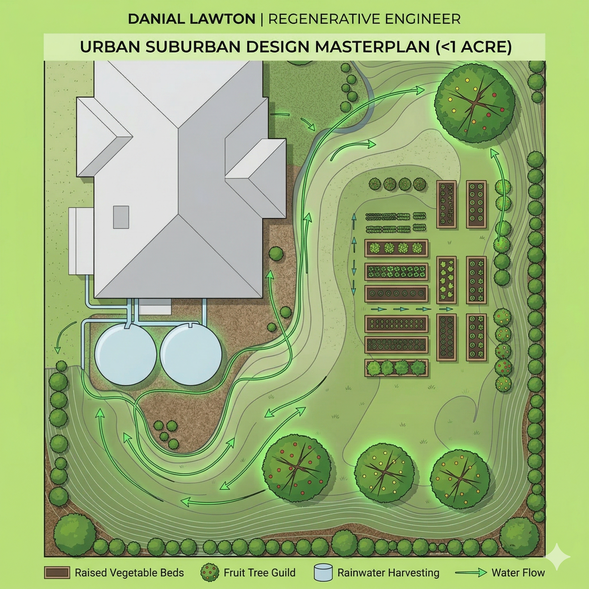
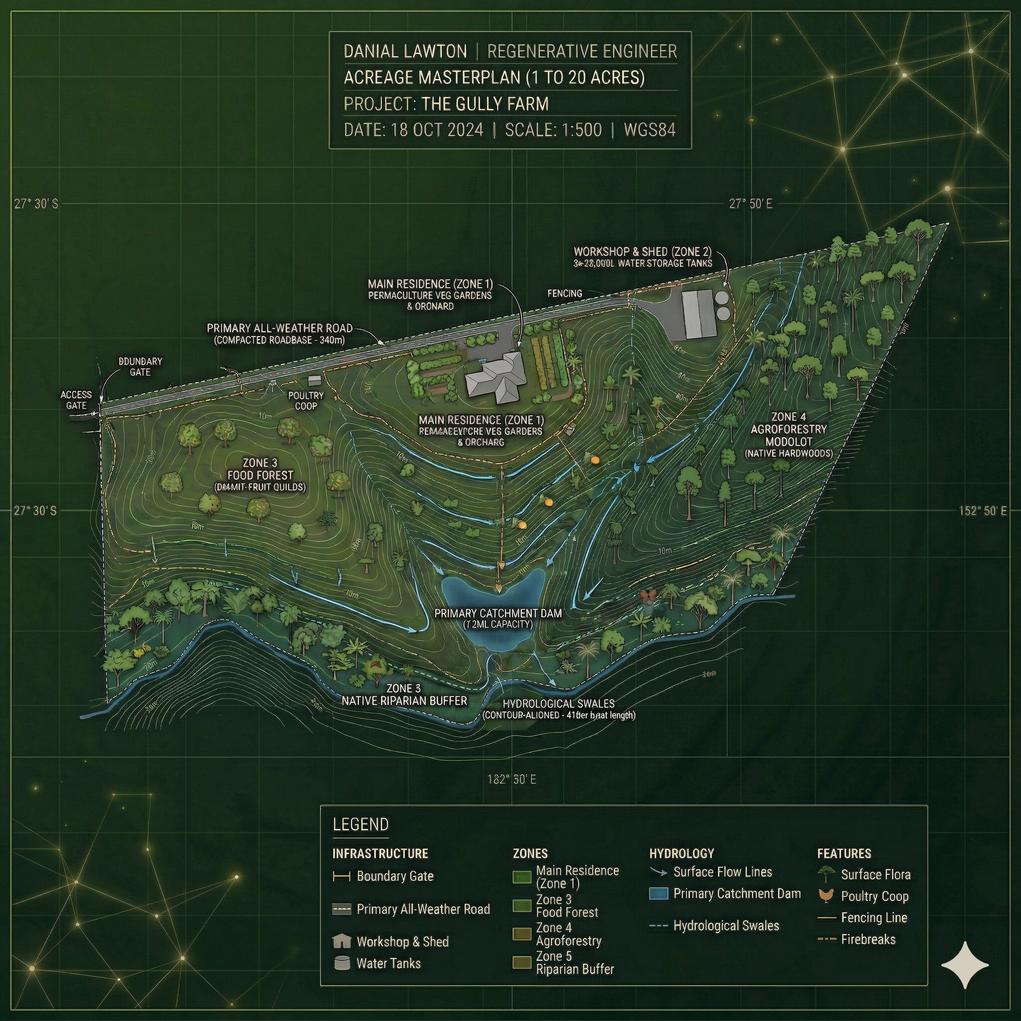
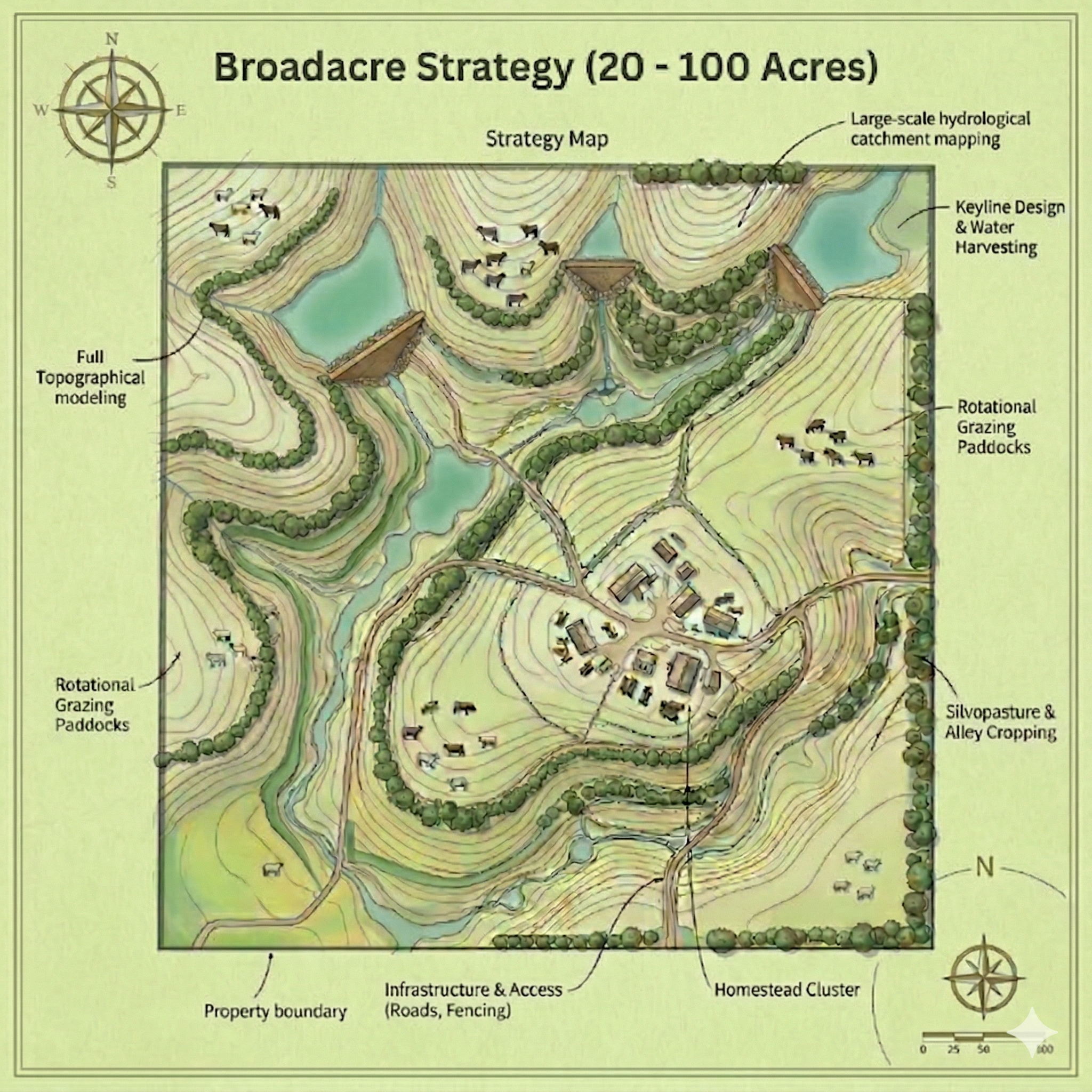
The greatest friction point in any permaculture project is the transition from a beautiful 2D drawing to a 3D landscape. Guessing the spacing of trees or the exact curve of a swale often leads to overcrowding or infrastructure interference.
Our GIS Planting Location Map removes all guesswork. We provide a high-precision digital overlay that places every major specimen and infrastructure element onto a coordinate-locked grid. This allows you—or your contractors—to walk the land with a mobile device and locate every planting site with GPS accuracy.
Product Description
Stop Guessing. Plant with Precision.
Note: This is an Add-On product designed to perfectly complement your Urban, Acreage, or Broadacre Masterplan.
You’ve invested in a premium earthworks and hydrology masterplan, but what goes into the ground next? Buying advanced fruit trees, timber species, and natives is a significant investment. Planting them in the wrong microclimate—where they might drown in a heavy wet season or bake during a drought—costs you years of lost growth and thousands of dollars in dead stock.
The Planting Location Map takes the broad strokes of your masterplan and zooms in. Utilizing the topographical and hydrological data we’ve already gathered for your property, we engineer a highly specific planting layout designed for maximum survival and yield.
What’s Included in this Add-On?
-
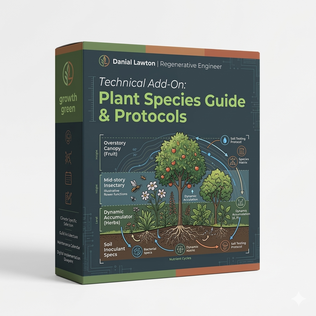
Precision Food Forest & Orchard Layouts: We map the exact locations for your high-value productive trees. We factor in sun angles, frost pockets, and wind exposure to place your food forest layout and orchard design in the ultimate microclimates for your specific site.
-
Earthworks Integration (Swale & Dam Planting): Plants are the ultimate stabilizers for earthworks. We provide exact placement strategies for planting on swale mounds, dam walls, and spillways to ensure your heavy infrastructure is locked together by deep-rooted, regenerative biology.
-
Windbreaks & Shelterbelts: Strategic mapping of protective timber and native belts to shield your home, livestock, and delicate crops from damaging prevailing winds.
-
Permaculture Tree Guild Zoning: We don’t just map individual trees; we map cooperative “guilds.” We show you exactly where to place your nitrogen fixers, dynamic accumulators, and main crop trees so they support each other naturally, reducing your need for external fertilizers.
The Deliverable:
You will receive a High-Resolution Digital Planting Overlay that matches your main property Masterplan.
Instead of looking at a blank zone labeled “Orchard,” you will have a precise visual map showing you exactly where the citrus goes, where the heavy timber goes, and where the frost-sensitive avocados will actually survive.
Maximize Your Investment: Ensure every tree you buy actually thrives. Add this precise permaculture planting guide to your cart to lock in the biological layer of your regenerative design.