• A quick, expert assessment before the bulldozer arrives.

    Have a specific problem you need looked at? Thinking about putting in a dam, cutting a swale, or clearing an access road, but want to make sure it won't cause a landslide or wash away?

    This 2-hour on-site consultation is designed as a rapid feasibility check. I will come to your property, walk the proposed earthworks sites with you, and give you an experienced earthworks operator's and environmental engineer's perspective on what is physically possible.

    What to expect:

    • Visual Feasibility Check: We walk your land and assess the viability of your ideas based on the visible slopes, soil, and access.

    • Problem Solving: Immediate, on-the-spot advice for failing earthworks, poor drainage, or erosion.

    • Next Steps: Clarity on whether you need a full engineering audit or if you are clear to start digging.

    (Note: This is a visual walk-and-talk consultation. For complex hydrological calculations and 1-in-100 year weather engineering, please view the 3-Hour Intensive Engineering Audit).

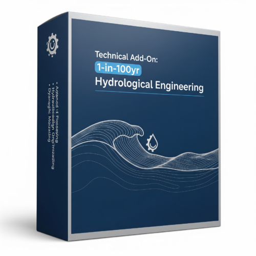
  • Add-On: 1-in-100yr Hydrological Engineering

    Price range: $1,500.00 through $4,000.00 +GST

    Civil-Grade Insurance for Extreme Weather

    Note: This is an Add-On product designed to perfectly complement your Acreage or Broadacre Masterplan.

    When managing large-scale catchments and heavy earthworks, guessing is not an option. A poorly calculated dam spillway or an undersized drainage system can result in catastrophic wall blowouts, severe topsoil erosion, and massive financial liability during extreme rain events.

    The 1-in-100yr Hydrological Engineering add-on provides civil-grade, mathematical certainty for your permaculture masterplan. Utilizing advanced GIS data and environmental engineering formulas, we model exactly how your property will handle a 1-in-100-year storm event (a massive, severe rainfall event with a 1% probability of occurring in any given year).

    What’s Included in this Add-On?

    • Peak Flow Catchment Calculations: We mathematically calculate the maximum volume and velocity of water that will enter your property from the macro-catchment above you during extreme weather events.

    • Precision Dam Spillway Calculations: The most common reason dams fail is undersized spillways. We calculate the exact width, depth, and level requirements for your dam spillways to safely pass a 1-in-100-year flood without compromising the dam wall.

    • Flood Mitigation & Overflow Routing: We map the safest, most stable routes for heavy overflow water to travel through your property, ensuring it safely bypasses your home, shedding, and delicate agricultural zones.

    • Culvert & Pipe Sizing: If your access roads cross natural watercourses, we provide the engineering data for the exact size of the pipes or culverts needed to prevent your roads from washing out during heavy wet seasons.

    The Deliverable:

    You will receive an Advanced Hydrological Data Report & Overlay integrated into your main property Masterplan.

    This data provides the exact specifications you need to hand to your heavy machinery operator. Instead of an excavator driver guessing how wide to make your overflow, they will have engineered, mathematical dimensions to work from.

    Engineer Your Peace of Mind: Don't build heavy infrastructure on assumptions. Add this hydrological engineering package to your cart to ensure your earthworks and water systems are built to survive the extremes.

    Select options This product has multiple variants. The options may be chosen on the product page Details
  • Add-On: Plant Species Guide

    Price range: $500.00 through $1,000.00 +GST

    This is an ADD-ON product a design must be purchased as well and can not be purchased independently.

    Beyond a List: A Roadmap for Growth

    A design is only as good as the life it supports. While many designers provide a generic list of species, our Plant Species Guide is a bespoke technical manual tailored to your site's specific microclimates, soil chemistry, and your personal capacity for maintenance.

    We don't just tell you what to plant; we provide the exact protocols for how to establish a self-regulating ecosystem that thrives in your specific corner of the world.

    Select options This product has multiple variants. The options may be chosen on the product page Details
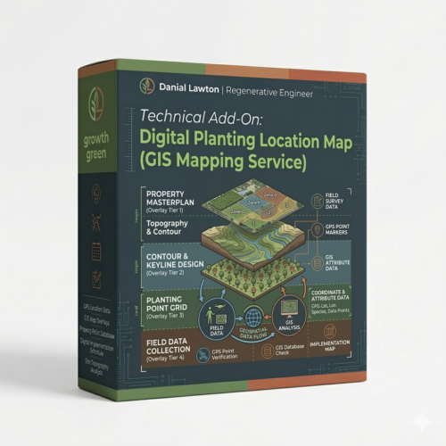
  • Add-On: Planting Location Map

    Price range: $1,000.00 through $2,000.00 +GST

    This is an ADD-ON product a design must be purchased as well and can not be purchased independently.

    Surveyor-Grade Precision for Implementation

    The "Blue Dot" Implementation System

    The greatest friction point in any permaculture project is the transition from a beautiful 2D drawing to a 3D landscape. Guessing the spacing of trees or the exact curve of a swale often leads to overcrowding or infrastructure interference.

    Our GIS Planting Location Map removes all guesswork. We provide a high-precision digital overlay that places every major specimen and infrastructure element onto a coordinate-locked grid. This allows you—or your contractors—to walk the land with a mobile device and locate every planting site with GPS accuracy.

    Select options This product has multiple variants. The options may be chosen on the product page Details
  • Don't guess with your landscape. Get an Environmental Engineer's perspective.

    The biggest mistakes in property development happen before a shovel ever hits the dirt. Buying land with hidden hydrological issues or placing infrastructure in the wrong spot can lead to devastating erosion, failed crops, and tens of thousands of dollars in wasted earthworks.

    Before you buy a property, hire a bulldozer, or start planting, you need a strategy rooted in scientific reality.

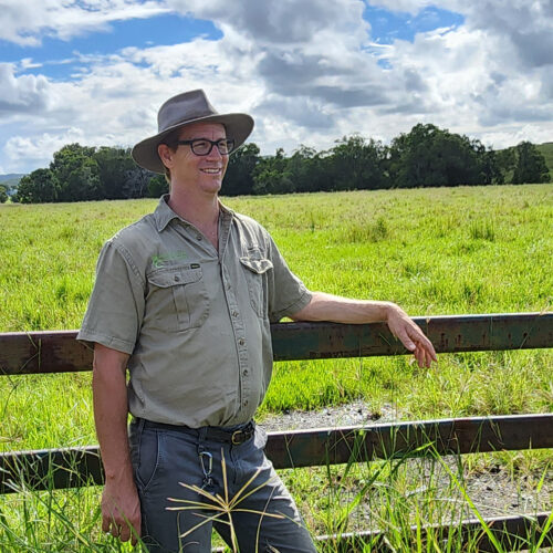
    As a 2nd-generation permaculturalist and an Environmental Engineer, I don't just give gardening advice. I analyze the physics of your landscape to ensure your vision is physically and financially possible.

  • Get a Custom Quote for Your Project

    Every landscape and project is unique. Whether you need complex hydrological earthworks, a regenerative property design, or an expert consultant to assess your land, I can help.

    With over 20 years of hands-on permaculture experience and a Master’s in Environmental Engineering, I specialize in designing and implementing systems that are scientifically rigorous and deeply regenerative.

    Use the form below to request a quote for:

    • Rural & Acreage Permaculture Design

    • Earthworks & Water Systems (Swales, Dams, Ponds)

    • Pre-Purchase Property Assessments

    • Project Implementation & Management

    • Workshops, Education, & Speaking

    Fill out the details below, add this to your cart, and "checkout" for free. I will review your project and get back to you with the next steps.

  • The 1-Hour Remote Strategy & Topography Call

    Fast, Expert Remote Strategy & Topography Assessment

    Have urgent questions about a prospective land purchase, building pad location, or water drainage issue? Book a Remote Permaculture Strategy session. Get direct, screen-share access to a Master Environmental Engineer to analyze high-resolution satellite imagery, GIS contour data, and catchment hydrology in real time.

    High-Level Engineering Advice from Anywhere

    You don't need to wait weeks for an on-site visit to gain complete scientific clarity on a property. By analyzing high-resolution 3D topographical models, satellite elevation layers, and catchment runoff physics on screen, we can evaluate your landscape remotely from anywhere in the world.

    Whether you are evaluating a real estate listing before signing a contract, troubleshooting an active erosion problem, or validating your DIY site plan, this focused 60-minute session gives you immediate, civil-grade answers.

    What We Cover in 60 Minutes

    1. Desktop GIS & Topography Analysis: Real-time screen-share analysis of site elevation, slope percentages, contour curves, and macro-catchment water flow feeding your land.

    2. Pre-Purchase Land Evaluation: Independent engineering assessment on prospective real estate listings to identify hidden flood risks, unviable building sites, landslip hazards, or road access challenges before you commit.

    3. Targeted Problem Solving: Direct, actionable advice on dam placement, swale feasibility, keyline suitability, or greywater/blackwater routing.

    4. Session Recording Delivered: Receive a full video recording of our screen-share session along with screen captures of your marked-up GIS maps for future reference.

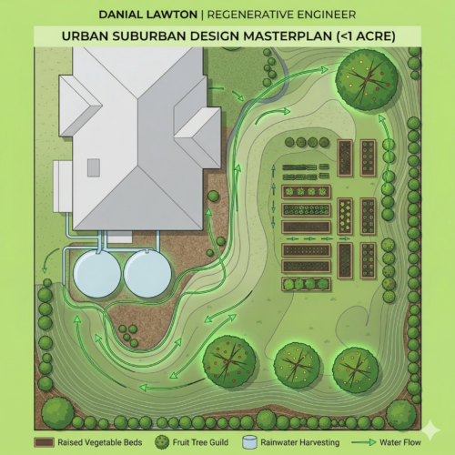
  • Urban & Suburban Design (< 1 Acre)

    Price range: $800.00 through $3,200.00 +GST
    GIS Site Concept & Zone Layout
    • Details: Turn your residential block into a highly productive, resilient ecosystem. We integrate structural zone planning, urban water harvesting, and planting strategies tailored to tight boundaries.
     
    Have you completed the Premium Remote Design Discovery below?
     
    Book Now. Add to Cart This product has multiple variants. The options may be chosen on the product page Details
Go to Top